By: Christopher W. Merritt, Ph.D., Utah State Historic Preservation Officer and Skylar Schulzke, Public GIS Specialist
Taking a spin on Madonna’s hit, “Material Girl”, it is clear that in the 21st century we need to use new technologies, “‘cause we are living in a geospatial world, and I’m a geospatial human”. Okay, maybe not the most eloquent entrance to discuss the topic, but I think the point is still captured. Since the first humans arrived on the scene, we have been mapping our place in the world whether in our heads, on bison hides, rock outcrops, papyrus, paper, or now, digitally. Space is as central to human experience as time, and you can’t separate the two.
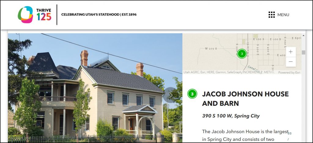
For the Thrive125 Project, the Utah State Historic Preservation Office within the Utah Division of State History (UDSH), built an interactive and story-telling map experience, to share some of Utah’s known 125-year old buildings. This map is one example of many such products that UDSH has created over the years that uses a relatively new web-based technology, called StoryMaps, to tell a spatially informed story. Developed and launched by the ESRI company, the StoryMap platform builds upon digital storytelling by allowing the creator to weave together photos, videos, graphics, and both static and user-interactive maps to create a narrative. Because humans relate to their world through space, using spatial storytelling helps us bring “history to life” in new ways. To learn more about StoryMaps check out ESRI’s website on the topic.
At UDSH and the SHPO, we use geospatial information systems, more commonly known as GIS, to manage our archaeological, historical building, monument and marker data, to name a few. GIS is an industry standard for tracking not only the location of archaeological sites and other resource types, but one the SHPO’s mandate under the National Historic Preservation Act of 1966, to maintain a database of known sites and surveys in our state. We serve out this data to the public, state and federal agencies, researchers, and private consultants through web-based platforms. While archaeological site location information is protected under State and Federal laws, you can see if your home or business is in our Historic Building Database or if your favorite historic plaque or location is in our Monument and Marker Database through our GIS-based online viewers.
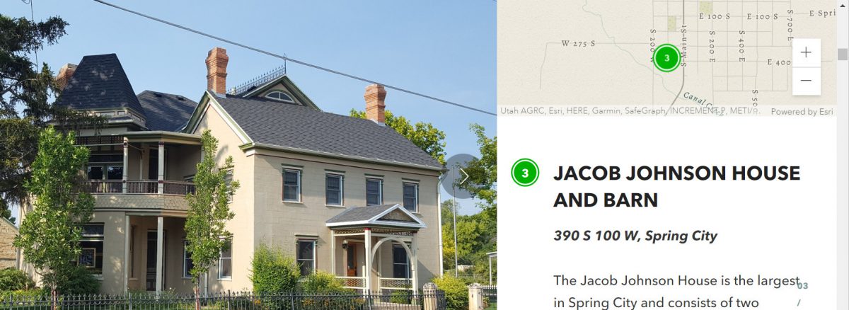
But data in a map only tells part of the story, and that is where the StoryMap platform comes together. In the case of our Thrive125 StoryMap, highlighting buildings that were built in 1896, we merged our existing GIS data with new photos, links to more information, and threaded all these different types of properties (Residential, Business, Industrial, etc.) into a narrative that leads the reader through this interesting period of Utah history.
We are lucky at UDSH that we have a great team of GIS Specialists, but we are also one of the few State Agencies to have a dedicated “Public GIS” position, whose job it is to make these types of fun and interactive resources to take all our data to the public. Please check out our Thrive125 map, but also check out, share, and learn with some of our other products from the last few years.
Other State History StoryMaps to Explore on our Website:
Veterans Memorials: In partnership with the Utah Department of Veterans and Military Affairs, we canvassed the state to identify, photograph, and map monuments and memorials commemorating our Veterans.
National Historic Landmarks: Utah is home to 14 National Historic Landmarks, a special category of sites through the National Park Service. These range from Desolation Canyon and the connection to John Wesley Powell, to the Mountain Meadows Massacre site in Iron County.
Public Archaeology Sites: Are you interested in planning a unique vacation or exploration effort? We have worked with our partners in State and Federal agencies to identify sites that are hardened and prepared for public visitation. Go explore!
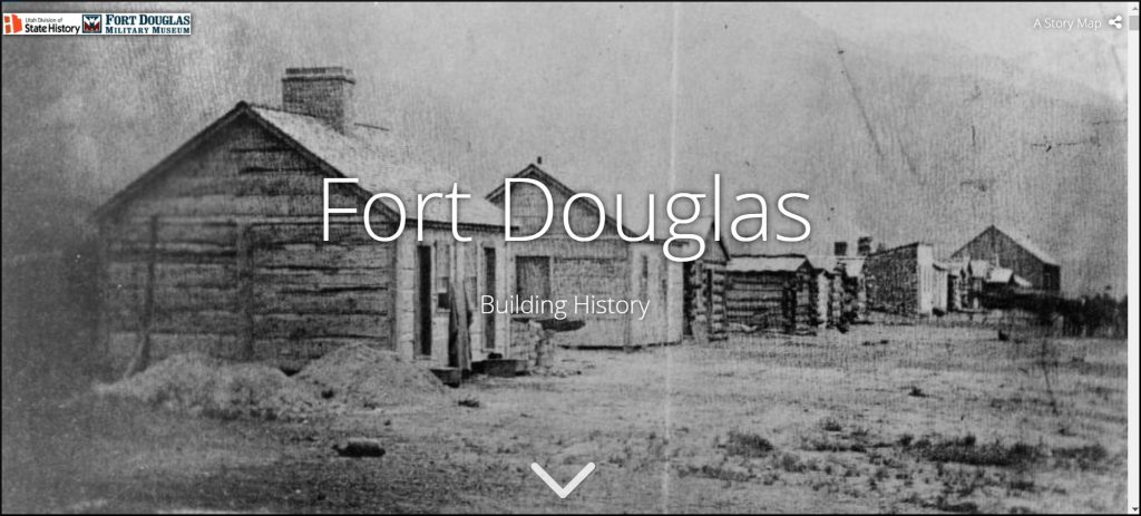
Fort Douglas Building History: In partnership with the Fort Douglas Military Museum and the University of Utah, we share the story of Fort Douglas’ changing boundaries and buildings through historic maps and photographs.
Happy Earth Day, Utah…from the Past: On April 22, 1970, the first Earth Day event was held. We have chosen to highlight a few notable historical authors, artists, explorers, pioneers, and early indigenous people influenced by Utah landscapes to help recognize Earth Day.
Women’s Suffrage: How the West Led the Way: In partnership with Better Days 2020, this storymap highlights the significant role the western States played in the Women’s Suffrage movement of the late 19th and early 20th centuries.
Contested Boundaries: Creating Utah State Lines: Few people realize that the boundaries of what became Utah changed, from the territories and homelands of Native Americans to the proposed State of Deseret.
Jedediah Smith’s Southwestern Expeditions: Using historical accounts and existing maps, we mapped the course of famed Mountain Man and Explorer Jedediah Smith through Utah and beyond.
Transcontinental Railroad: Utah is lucky to have been the home of the May 10, 1869 “Golden Spike” ceremony that celebrated the completion of our country’s first transcontinental railroad. This story map shares some of the history but also lets the viewer explore the sites today.
Mt. Timpanogos, February 1916: In 1916, Dean R. Brimhall completed a winter ascent of Mt. Timpanogos. This map highlights the route taken as recovered from his accounts.
Films in Utah: In partnership with the Utah Film Commission, we identified filming locations in Utah and made a number of maps telling the stories, including Horror Movies, Winter Movies and Western Movies